Cossatot River
Easy/Moderate
89 miles
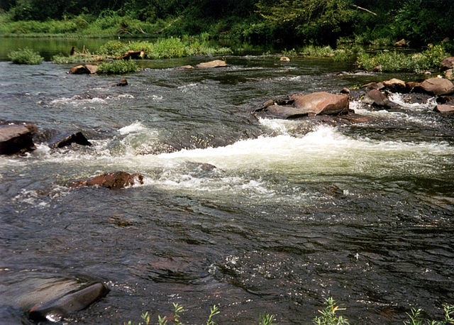
About this Waterway
The Cossatot River, dubbed “Arkansas’s wild river,” stretches 89 miles from the Ouachita Mountains near Wickes in Polk County to Gillham Lake, then the Little River. Famous for its Class III-V rapids, especially at Cossatot Falls, it’s a thrill-seeker’s kayaking and canoeing destination. Access points include Hwy 246, Ed Banks Bridge, Cossatot Falls (via park), and Hwy 4. Camping options feature: Cossatot River State Park-Natural Area (Sandbar Area, tent sites), and primitive sites near the falls and along the river. Its rugged terrain and whitewater make it a standout for experienced paddlers.
Access Points
Safety Tips
Activities
Amenities
Current Conditions
Weather information coming soon
Nearby Camping
Camping information coming soon